Archive for January, 2012
Update from Saturday, Jan 14
Day 6 and still at base camp. yesterday we made it up to camp 1 at 16000 ft to drop off some equipment…then back to base camp. tomorrow we go back to camp 1 to stay. i will use my SPOT in the morning so you can track our move.
They Made it to Basecamp
From Ash’s teammate, Jordan: Hola! We are currently at basecamp where we will be for 3 days. i was able to buy some time on a satellite connetion to make this post. Everyone in the group is healthy and ready to start moving gearto camp 1 tomorrow. then we will return to basecamp for an aclimatization day. you wíll not see SPOT movement for a few days.
Camp 2 in the Vacas
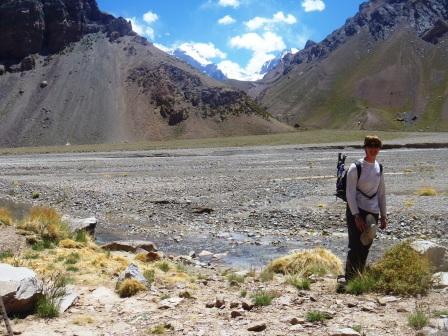
Today we got our first view of the mountain about 5 minutes from camp 2. The mountain is the one to the left as you look through the col behind me.
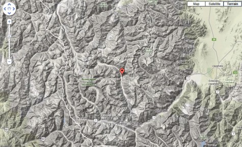
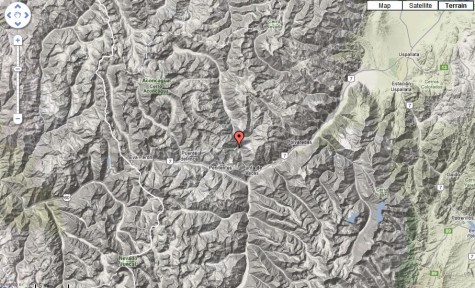
Spot location for Camp 2 – Casa de Piedra at 3200m our second camp in the Vacas Valley

Some flowers along the way. There are lots of beautiful plants in the valley as well as a few different types of birds.
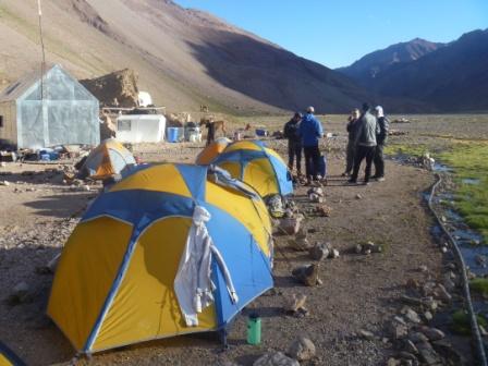
Tents up at the end of the day at 3200m having just had our first view of the mountain.
Entrance to first camp in the Vacas Valley
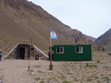
This was the entrance to the park at the Vacas Valley side. So we showed our permits here and headed on up the valley without Jordan and Jonathon as Jordan’s bag had been lost by Lan Chile but luckily was found in time for them to join us that evening at out first camp site.
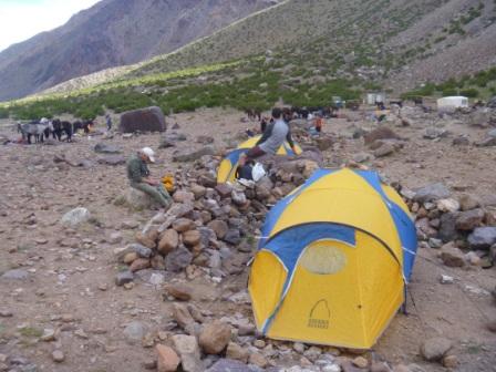
First camp (Pampa Lenas – 2800m) after a very hot day of hiking but with day packs only as the mules were carrying everything for us to base camp.
Aconcaqua the route and plan
So I have got a lot of emails over the last few days about my upcoming climb. I am meeting the group in Mendoza on the morning of the 6th and we head for the mountain on the 8th. The first day will just be the drive up to Penintetes and then we start walking from there on the 9th.
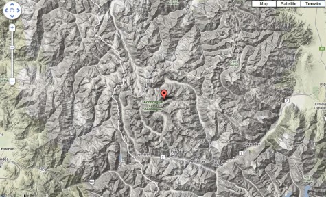
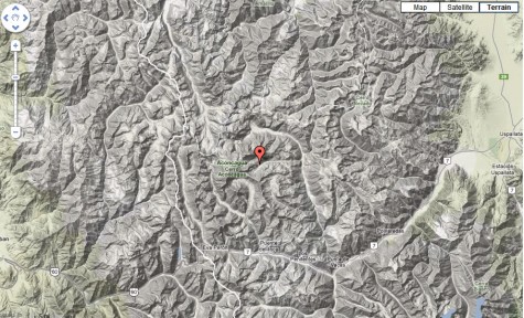
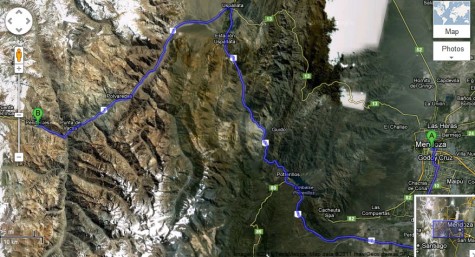
This is the route on Google Maps.
I went past Penintentes yesterday on the way to Punta Del Inca and saw the mountain mostly shrouded in clouds. It is a big one! I walked a little bit as well at the same height as base camp and it is harder work than at sea level I was out of breath a little bit in comparison to what I would be normally.
The timetable is as follows
8th January Travel to Penintentes
Day 2 7 mile walk with only 61m of height gain to Pampa Lena
Day 3 8.3 mile walk with 546m height gain to Casa Piedra at 11000 feet
Day 4 6 mile walk to base camp Plaza Argentinas 546m height gain to base camp at 12800 feet
Day 5 Acclimatization day
Day 6 Carry to camp one at 16000 feet 2.3 miles
Day 7 Acclimatization day at Base Camp and medical clearance by base camp Dr
Day 8 Move to camp one with second load of gear
Day 9 Acclimatization day at camp one
Day 10 Carry to camp two at 18000
Day 11 Move to camp two at 18000 feet with second load of gear
Day 12 Rest Day at camp 2
Day 13 Carry to Colora camp at 20000
Day 14 Move to Colora camp with second load of gear
Day 15 Summit Day round trip back to high camp total fourteen hours
Day 16 Colora camp to Plaza de Mules
Day 17 Plaza de Mules to Los Penintentes
Day 18 Los Penintentes to Mendoza
We have an extra 2 days of contingency just in case we need more for weather or acclimatization.
Remember you can still sponsor me I am raising money for some great causes.
http://www.justgiving.com/Ashley-Perrin for people wanting to donate to Ellen Macarthur Trust – UK charity
We need 100 pounds more to send one kid on a week long trip.
http://www.firstgiving.com/fundraiser/ashleyperrin/ashleyperrinsfundraisingpage for the US charity Paws for Patriots
Permits and Penintentes
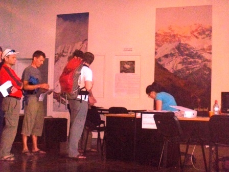
Our guides were first in line for the permits there were a lot of people waiting outside for a 9am opening which given Argentine watches meant 9:30am!
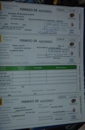
This is my permit. We now head to the supermarket to get last minute veg, eggs etc. Then jump in a van for a 3 hour ride to Pentinentes which is a dying ski town close to the border with Chile. I went past it last week when we went on the trip to the border statue. We will spend the night there then put all our gear on mules for the three day trek to Plaza Argentinas which is our base camp as we are doing the False Polish route up the mountain and the normal route down the other side.
Remember you can still sponsor me I am raising money for some great causes.
http://www.justgiving.com/Ashley-Perrin for people wanting to donate to Ellen Macarthur Trust – UK charity
We need 100 pounds more to send one kid on a week long trip.
http://www.firstgiving.com/fundraiser/ashleyperrin/ashleyperrinsfundraisingpage for the US charity Paws for Patriots
Thank you to those who have been so generous in their donations so far it is much appreciated. In the meantime my blog will be updated by my good friend Scott if he gets the location information of where we are at on the route so please keep on looking on my site.
Tents, stoves and people
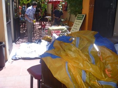
We checked the stoves and cleaned the tents including waxing the zips. We also met the rest of the team total of 7 of us and had dinner together tomorrow it is time to pick up permits and head to Penitentes.
Tom and Jonathon from Alaskan Mountain Guides
Derick from Kentucky
Barry Dr from Canada
Laura Lawyer from NY
Jordan from San Diego
And myself.
Aconcaqua Challenge for Charity
 European friends please visit my Just Giving Page and donate so I can raise tons of money for the Ellen Macarthur Trust.
US friends I will be raising money for Paws for Patriots my page is at First Giving. Thanks so much for reading and donating!
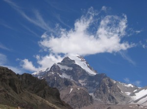
In January 2012 after leaving South Georgia by ship I will fly from the Falklands to Argentina to climb Aconcaqua. At 6958m (22,829ft) the mountain is located in the central Andes near the border with Chile. It is one of the 7 summits and is the highest mountain in the western and southern hemispheres. I will be climbing the mountain as part of a 24 day High Altitude Guiding Course with International Mountain Leadership School.
As there are no porters we will be double carrying loads of 25kg (55lbs) (lighter than my winter pack here in South Georgia – thank goodness) up the mountain hopefully summiting on day 15. Load carrying days will be up to 8 hours and include 700m (2296) of ascent. High on the mountain temperatures can drop to -25. Summit day can last up to 12 hours and begins at 5:00am. We climb the North Ridge , traverse the West Face and climb into the Canaleta a couloir leading to the Guanaco ridge and traverse to the summit. All around are the Andes mountains several peaks just over 6500m. To the west lies the Pacific Ocean and the east the plains of Argentina.
Above 5500m (18040ft) is considered to be Extreme Altitude above 7000m (22960ft) is what is called the Death Zone. What this means is that as we go higher up the mountain there is less oxygen for our bodies which is of course required to keep your body alive. Therefore there is plenty of time in the climbing schedule for acclimatization allowing our bodies to adapt to lower oxygen by making more red blood cells to carry more oxygen. However, no matter how much acclimatization the altitude will make things a lot harder.
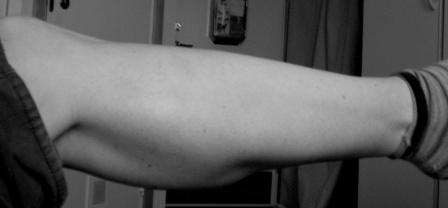
In order to succeed in this challenge I started training when I arrived in South Georgia in October 2010. My regular training means I do 16 sessions of exercise a week – 5 morning runs or rowing sessions, 5 weights sessions and 6 long runs or load carrying sessions a week (this winter I have been skinning instead!). As a result I had to extend my ski boots to fit my calves which were weedy as befitting of a sailor. I did have a picture of my calves taken by Ali but they are so white and gross looking I couldn’t bring myself to put the picture up! Instead I took one in black and white which isn’t so bad 🙂 – they are very white as a result of not seeing any sun for almost a year. First person to donate 50 quid/$75 and I will remove the offensive picture!
The Ellen Macarthur Trust is a great charity set up by a friend of mine to take kids with Cancer Sailing.
What will the money you donate do?
£20 covers the cost of one young person’s victuals for one trip
£50 will provide a UV-resistant T-shirt and cap to protect the young person from the sun
£500 allows us to take one young person sailing on a four-day trip
The Paws for Patriots program was recommended to me as a charity to support by my cousin Natalie’s husband Patrick who is ex US forces. They provide guide dogs to wounded veterans so this is a great way to help out wounded veterans as well as giving dogs a worthwhile job.
Bag and food packed
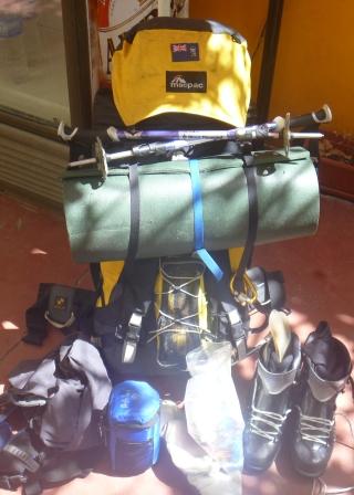
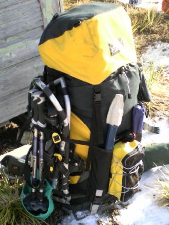
So the food has been put into ziplock bags by meal and my bag is packed ready to go. I was amazed it all fit in with the exception of my sleeping mat which will have to be attached to the outside and my plastic boots which will be on my feet. We have food for 20 days for 7 people in three large duffels which when we get to Pentinentes will get packed into barrels carried by mules for three days to base camp. One person has had to cancel last minute as they are ill. Today we have some last minute food buying before we head to Penintentes tomorrow after picking up our permits.


